Iroquoia Section - Crawford Lake (104.5 km) to Mount Nemo (91.0 km) - March 13, 2025.
Iroquoia Section - Crawford Lake (104.5 km) to Mount Nemo (91.0 km) - March 13, 2025.

After over a month off the trail due to a seemingly endless stretch of inclement weather on consecutive Thursdays having caused frustrating cancellations, Hiking With Friends were finally rewarded with a classic late winter day to get out and enjoy our favourite walking path...and we took on a 15 km route from Crawford Lake southward to Mount Nemo with all our pent up energy (which, it turned out, was well needed to complete the journey)...and there was a nice celebration at the end to cap off a glorious outing!..


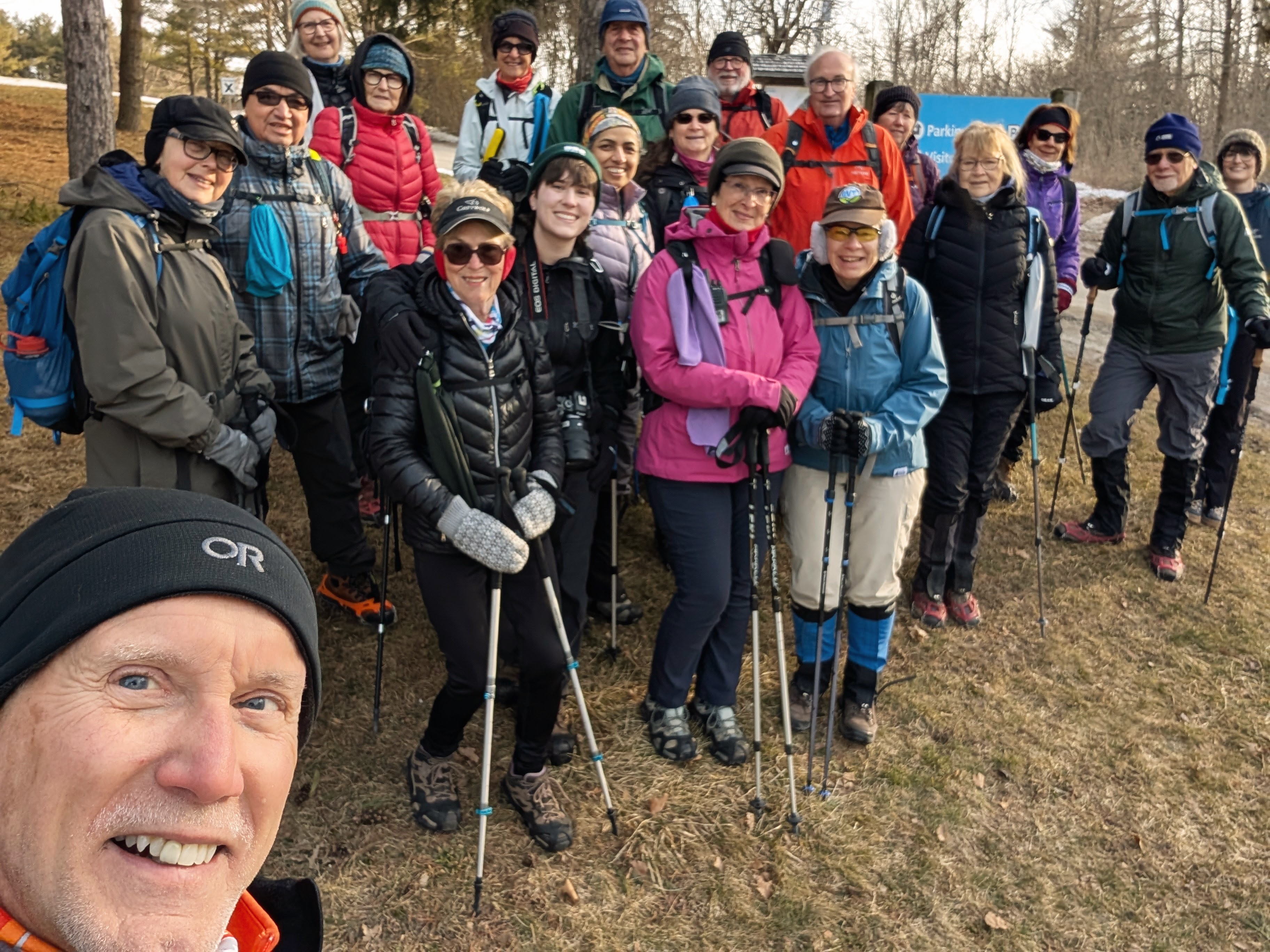
While hiking the Bruce Trail is our passion and we are seemingly quite proficient at it, our logistical organization can often be "a work in progress"...fortunately, with an experienced hike coordinator in charge, we eventually got sorted out and successfully assembled our group of 20 hikers in the parking lot at Crawford Lake to get our morning selfie shot on record...today's hikers include myself, Grace, Ivan, Barbara, Frances, Rita, Annette, Nic (guest hiker/photographer), Renu, Doug, Faryde, Andrew, Lesley, Steve K (H.C), Georgia, Rhonda, Marleen, Catherine V, Ron B, and Sarah (guest hiker)...

Today's hike will be a special one for Rita, who will complete the Iroquoia Section...and joining us to help capture her big day, and enhance their blossoming photography portfolio as a soon to be graduate Sheridan College student, is her enthusiastic grandchild, Nic...


We are initially required to take a portion of the Crawford Lake Side Trail to access the main trail but that is a blessing, as we get a chance to appreciate some of the amazing wood carvings that grace this area...


After crossing Guelph Line, we enter the beautiful Crawford Forestry Tract and winter hiking conditions are pretty much ideal...the sun is rising higher and warming us, there is little wind, and the trail, while icy and uneven in spots, is at its frozen, crunchiest best...


The beauty of the morning, needless to say, helps put smiles on our faces, and we are inclined to stop on a bridge and capture the moment...


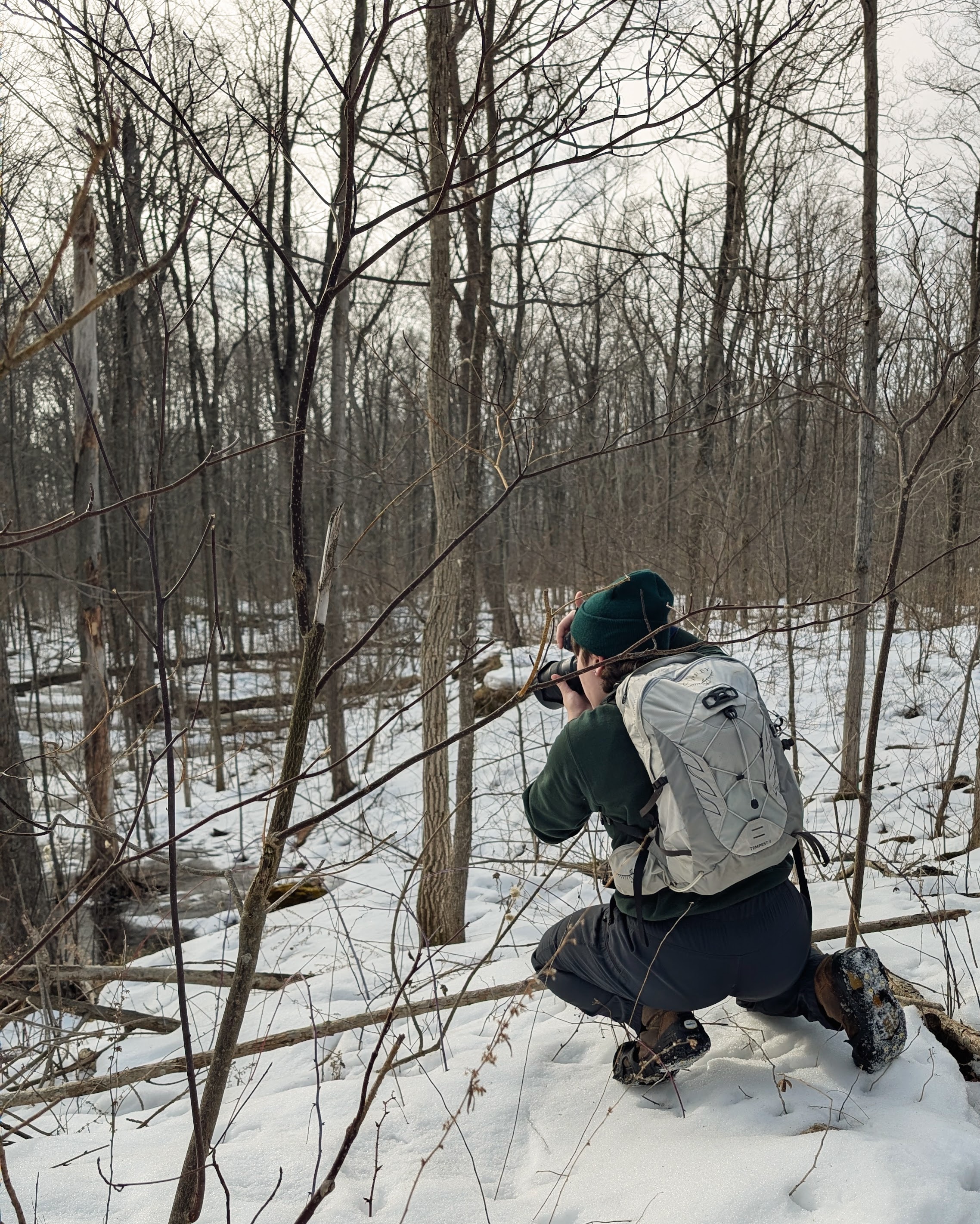
After a bit of a technical climb, Nic gets down to capturing some of the natural attractions...


Our descent onto Twiss Road is followed by a short break for clothing adjustments and hydration...


The next part of our route will take us through the Yaremko-Ridley Park, where there are no man made carvings, but definitely some wildly organic works of art...


Exiting the park leads us to the recently rerouted trial section in Kilbride...this new pathway means you don't have to suffer the sketchy narrow road shoulder walk along Derry Road over to Twiss Road any longer...instead, a nicely groomed trail now leads to the Kilbride Elementary School where the deserted playground (being March break) provides a warm, sunny spot for our break, of the refreshment kind...


We roam the streets of Kilbride for a couple of kilometers basking in the warmth of the impending spring weather...the receding snowbanks are sublimating before our eyes...


Actual melting snow has begun to engorge Bronte Creek, as we discover after taking the long, slow climb down into its valley...


There's a reason they rebuilt this bridge as high as they did, there is a massive flood plain at the bend in the creek, but the awkward re-bar steps down can mean things get a little backed up on the span at rush hour...


The climb out of the valley up to Britannia Road is when many of us began to really feel the burn after hiking for several hours on sketchy ice, uneven crust, and sloppy, soon to be messy muddy, snow mush...fortunately, we can take a break from our icers with a good stretch of pavement ahead...we catch our collective breath and head south on Blind Line, with the end of our line "in sight"...


While most "E2E's" in the group elect to remain on the solid footing of the pavement (to, ahem, reduce the risk of injury) while heading east on Colling Road, those requiring this portion of the trail in order to ultimately achieve that status must adhere to the actual path that parallels the road on the south side of the ditch...the short boardwalk just before Guelph Line allows them to finally exit this unparalleled walk of penance...


This amazing woman, who shows such grit and determination, is a shining example of how the Bruce Trail can draw you in, and draw out of you what you maybe didn't know was there...physical exertion in exchange for visual wonderment, shared with hiking friends, and the chance to complete Canada's oldest and longest marked footpath is an alluring combination...Rita is now another step closer with her conquest of the Iroquoia Section...congratulations!

The End...almost...
As an added bonus, Nic has allowed me to download a few samples of what they captured on this special day...we look forward to getting a link to the full portfolio in the not too distant future...


Comments
Post a Comment