Sydenham Section - Series #2 - June 3 -5, 2025.
Sydenham Section - Series #2 - June 3-5, 2025.
-----------------------------------
Day One - Blantyre (0.0 km) to 1st Concession S. (10.5 km) - June 3, 2025.

A beautiful day, a modest 10.5 km hike (according to the BTC app).
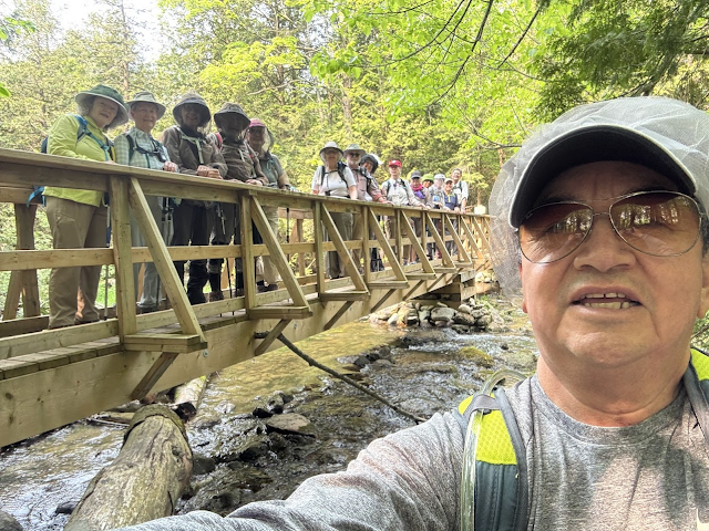
Even before we set off many of our hikers took no chances with mosquitoes and black flies ... from the left, Renu, Laura, Nancy, Peter, Lesley, Catherine, Faryde, and trying her best to be anonymous, Donna.

The official start photo ...

Andrew (photos), Domenic, Peter, Laura, Renu, Nancy, Catherine C., Barbara, Ivan (photos), Doug (HC & photos), Frank C., Lesley (photos), Sandra (sweep), Marion, Faryde and, still anonymous, Donna (photos).
Off we went, full of vim, at the start of the Sydenham Section. We had hardly started when Doug, in the lead and chatting happily to Andrew, missed the turn to the right and took us a few hundred meters up the track before Andrew realized that we were off-piste. Zut!
The Rocklyn Creek Bridge.
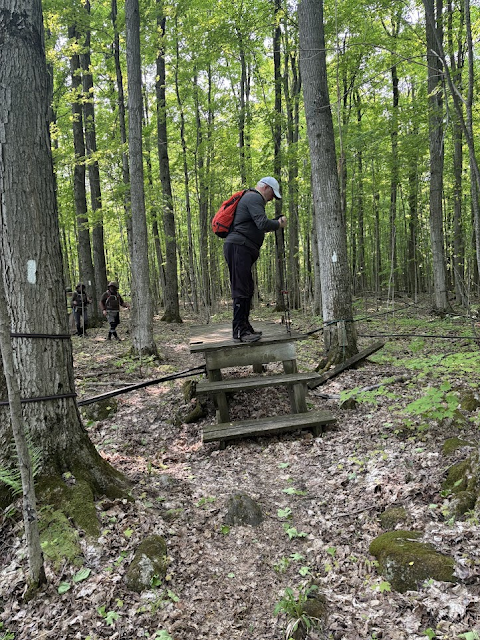
Dom carefully navigating a rickety platform over maple-syrup lines.
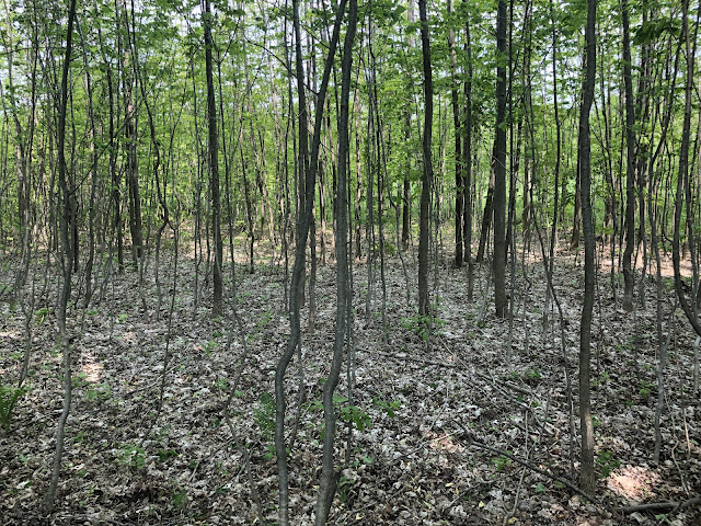
The woods were beautiful, and we were joyful.


Elevenses ...


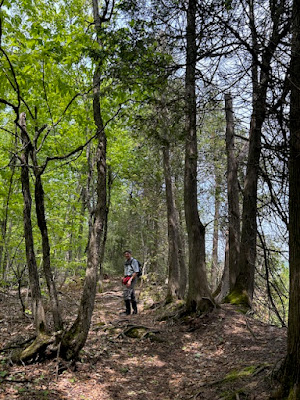
Some road walking for a short stretch before diving back into the woods.

Gravel trucks were a menace.


End of Day One
--------------------------------------------
Day Two - 1st Concession S. (10.5 km) to Bognor Marsh (27.0 km) - June 4, 2025.

Another sunny and warm day, with rain forecast for the late afternoon.
Nominally 16.5 km (BTC app) but several klicks longer according to the various smartwatches our hikers were wearing. (No two watches agreed on the distance, but it felt longer.) However, much of the hike (10.1 km) was road walking so we made good time and finished before heavy rain started around 4pm.

Andrew (photos), Peter, Laura (photos), Marion, Donna, Lesley (photos), Sandra (sweep), Doug (HC and photos), Catherine C., Renu, Faryde, Ivan (photos), Barbara.


Renu (photos), Ron B. (photos), Catherine C., Doug (HC & photos), Lesley (photos), Donna, Marion, Barbara, Laura, Peter, Faryde, Ivan (photos).


Then we left the Bognor Marsh and climbed to the escarpment top. Savage and slippery, the endless rocks made for slow progress. We started hiking at about 8:45 am. We did not finish until almost 4:00 pm!


No pictures of lunch, but Lesley dropped some cutlery down a small cliff and Doug gallantly retrieved them for her.

Nearing Highway 26 and Woodford, we came across some "No Trespassing" signs right across the trail. Blazes beyond had been blacked out but we could not see diversion blazes.

What's more, the BTC App indicated no diversion. Nervously, we pushed on, following what appeared to be the main trail, cheering whenever we came to an intact (but faded) blaze. Eventually, we won through to BTC land and fresh blazes and encountered a lovely crevice sequence which the main trail penetrates. Our entire group opted for the main trail, bravely eschewing the Crevice Springs Side Trail ...


Colpoy's Bay in the early morning.


Lesley (photos), Ron B., Barbara.


A (male?) Ruffed Grouse.

At Wiarton Willie's limestone statue in Bluewater Park.

Off we go, on the road ...
Andrew (photos), Peter, Laura (photos), Marion, Donna, Lesley (photos), Sandra (sweep), Doug (HC and photos), Catherine C., Renu, Faryde, Ivan (photos), Barbara.
Briefly off-road, we walk along the edge of a lovely meadow and startle a deer.

Then lots of road, pestered for a while by a grader chugging by us, back and forth, as we walked.


Back on the road for the rest of the way, we put our cameras away and marched. Nearing the end at Bognor Marsh, we saw what we thought was a Sandhill Crane, then we heard the musical and unmistakable call of a crane, and a flotilla of them sailed overhead. Magical! Mesmerized, none of us took a photograph.
Back at the Nights Inn, after the rain had stopped, this amazing tricycle was delivered on a flatbed. It had disappeared by the time we got back from dinner, but not before Lesley and Catherine posed beside it.


End of Day Two
----------------------------------------
Day Three - Bognor Marsh (27.0 km) to St. Vincent/Sydenham Town Line (41.7 km) - June 5, 2025.

Yet another dry and sunny day, but after the rain last night, muddy and slippery in the woods the whole 14.7km. No road walking! There were 12 of us:

Renu (photos), Ron B. (photos), Catherine C., Doug (HC & photos), Lesley (photos), Donna, Marion, Barbara, Laura, Peter, Faryde, Ivan (photos).
Bognor Marsh was magical.


Then we left the Bognor Marsh and climbed to the escarpment top. Savage and slippery, the endless rocks made for slow progress. We started hiking at about 8:45 am. We did not finish until almost 4:00 pm!


We came across a weird tree, burying its head in the ground and making a complete arch ...

No pictures of lunch, but Lesley dropped some cutlery down a small cliff and Doug gallantly retrieved them for her.

Nearing Highway 26 and Woodford, we came across some "No Trespassing" signs right across the trail. Blazes beyond had been blacked out but we could not see diversion blazes.

What's more, the BTC App indicated no diversion. Nervously, we pushed on, following what appeared to be the main trail, cheering whenever we came to an intact (but faded) blaze. Eventually, we won through to BTC land and fresh blazes and encountered a lovely crevice sequence which the main trail penetrates. Our entire group opted for the main trail, bravely eschewing the Crevice Springs Side Trail ...


Then we were through Woodford and the final kilometer to the St. Vincent - Sydenham Townline and our cars. Our final photograph: the muddy boots.

End of Day Three. A wonderful three days!
------------------------------------------

Epilogue - June 6, 2025
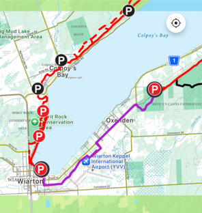
Ron B. needed to hike the 7.9 kilometers from Bruces Caves to Wiarton for his End-to-End. Barbara and Lesley generously stayed overnight in Owen Sound to accompany him.
Colpoy's Bay in the early morning.

The start.

Lesley (photos), Ron B., Barbara.
Off they go ...


A (male?) Ruffed Grouse.


Epilogue End


Comments
Post a Comment