Caledon Hills Section - Innes Road (31.5 km) to 7th Line (43.3 km) - May 23, 2024.

 Caledon Hills Section - Innes Road (31.5 km) to 7th Line (43.3 km) - May 23, 2024.


Hiking With Friends was found roaming in the Caledon Hills section of the Bruce Trail this past week as they took on a 12 km route from the designated parking area on Innes Road to the lot at 7th Line and Airport Road...this is a unique geological area where the Niagara Escarpment reaches the Oak Ridges Moraine and is the most easterly portion of the B.T north of Lake Ontario...

Our 4 hour outing was an "up and down" affair that required a pretty decent 430 meters of climbing and I can assure you that the landscape was a whole lot greener than (most of) the above view suggests (likely the aerials were taken in the winter months)...


With some cars dropped at our end point and the shuttle over to Innes Road complete, we assemble our group of 18 hikers under gorgeous morning sunshine to get our hike underway...there's myself, Frances, Annette (H.C), Nancy, Frank, Marleen, Sandra, Andrea, Barbara, Andrew, Rita, Josie, Liz, Steve R, Lesley, Steve K, Rhonda, and Geoff...


As we head to the top of Innes Road and enter the forest, it is pretty evident that the overall hiking conditions are just about ideal this morning...comfortable temperature, low humidity, decent breeze to hopefully keep bugs away (spoiler alert: it did), and glorious, "not a cloud in the sky" type, sunshine...days like these need to become treasured memories...mostly to help when things are not so ideal!


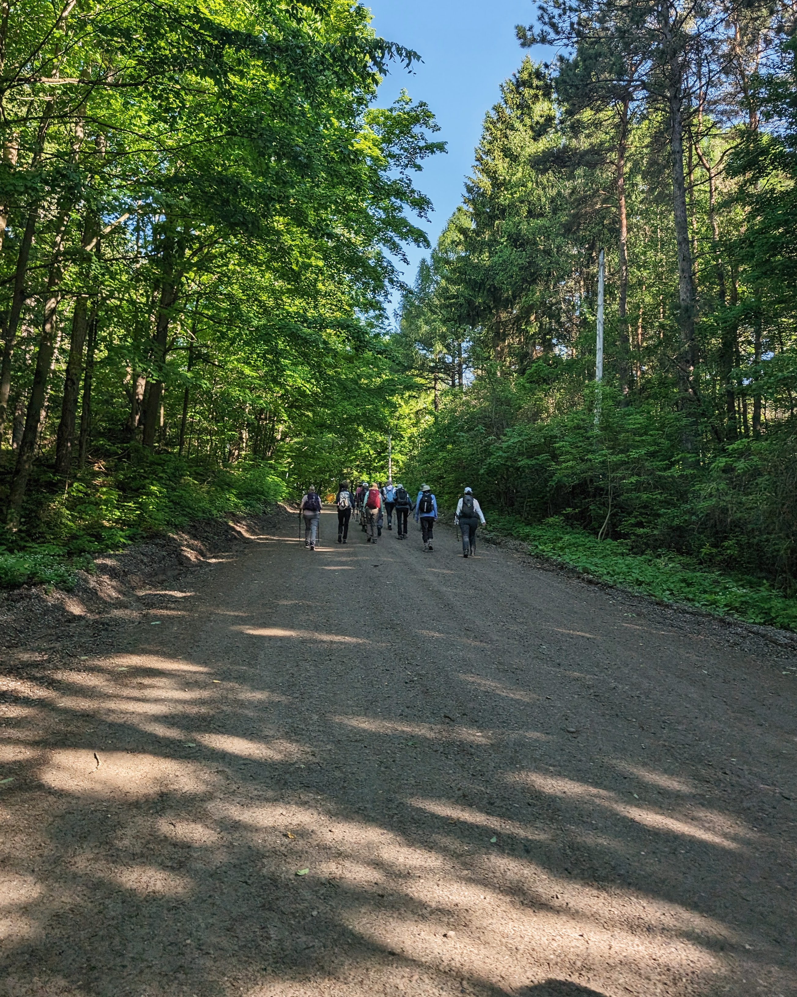
The first impression having entered the woods is the intense lushness of the undergrowth, and the cooling effect of the now dense tree canopy above...the forest is alive and bathing us in nature...we enter Glen Haffy Conservation Park...our passage through this beautiful area will account for a good portion of today's outing...


 It's smooth sailing on a wide, dry, and easy trail....well, until it isn't...then it's time to play "stream hopscotch"...some go one way, others choose to try their muck, uh, luck another way...


As my father used to say, "stand up and be counted"...(or was it "sit down and be quiet"?)...well, here I am, letting the Toronto Area Conservation Authority know I was "just passing through"...nothing to see here, other than nature at it's finest...


After being counted and traversing Coolihans Side Road, a stile crossing leads us to a wonderful clearing used by picnickers and the like...


 It has been a spectacular late spring day and our hike is progressing well...the smell of lilac in the light breeze is just "icing on the cake"...the Bruce Trail is showing it's best face today!..


Maybe our bridge picture game has dropped a little bit in recent times...they just don't get the respect they used to...sometimes our group momentum means we don't want to be troubled as we pass over water?..


Well, no time to "lay me down" apparently ...we have a hike to complete...


Our peaceful surroundings start to have intrusive traffic noises, and that means we are nearing a busy Highway 9 and its plethora of cars and trucks...


We descend to just below the grade of the roadway and travel eastward until the path comes up to meet the pavement...


In previous times, it was a common practice for those who had their E2E to avoid the long walk up to the corner of Airport Road, crossing over, and then returning on the other side to the trail entrance, and just risk sprinting over to the opposite shoulder (not a really safe option to be fair)...we decide today to all take the proper course, and it's a good thing...because there has been a re-route that I suspect was designed with just the intention of removing that temptation...


The trail now takes you in behind the fire station (and past a moose who's on a "real estate"), and then winds down to reconnect near where the previous road crossing access would have been...certainly an improved route in my mind...


  After Lesley and Sandra humor me with a mini bridge pic, we decide that this sunny clearing is a great place to idle for a while and get some refreshment...


There are a couple of more stream valleys to cross which means more "down and ups" but on a day as beautiful as this one has been, it doesn't seem quite so difficult...the trail conditions have been marvelous...


Our arrival at the Humber Heights lookout area means that the hike is just about over, so why not linger for a few minutes and appreciate our surroundings?..


Eventually it is time to cover the last few steps back to the parking lot and the iconic Inukshuk, which Steve felt needed to be moved over just a few feet...we have had an amazingly nice day on the Bruce Trail and the it has been a great precursor to our first spring trip up to the peninsula next week to take on that formidable section...more adventures await for Hiking With Friends and, as usual, it will be a pleasure to share them with you!


The End


If you're relaxing in Bronte Harbor after a long hike, check out the latest addition to the amazing collection of Muskoka chairs there, "Trees of Bronte Village" (assembled by me, painted by my wife and daughter).


Comments

Popular posts from this blog

Peninsula Section - Series #1 Covering from the Start at Wiarton (0.0 km) to Jackson's Cove Rd. (52.0)...with a visit in Sydenham Section to the Bruce's Caves

Iroquoia Section - Sydenham Road (58.8 km) to Grindstone Falls ( 71.2 km) - Jan. 25, 2024.

Iroqouia Section - Guelph Line (81.6) to Grindstone Falls (71.2) - April 18, 2024